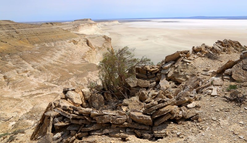
 The Ustyurt Plateau captivates the imagination with its harsh beauty. It is a vast, almost perfectly flat clay-sagebrush desert that abruptly drops to the surrounding lowlands and the sea with towering cliffs known as "chinks", reaching heights of 300-400 meters. For thousands of years, it has served as an important region for nomadic peoples, evidenced by numerous ancient burial sites, caravanserais, cultic structures, and mysterious ancient stone constructions known as "arany".
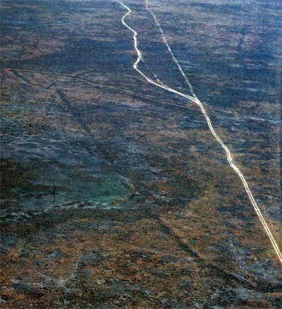
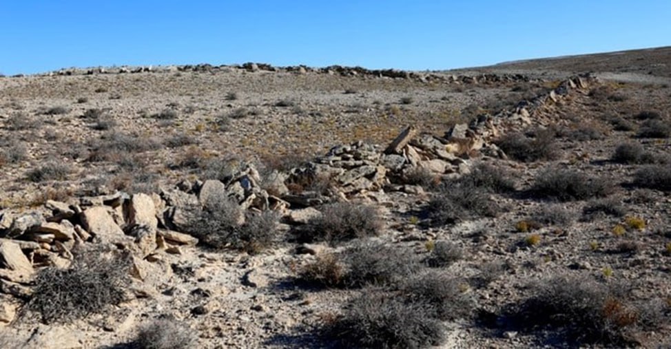
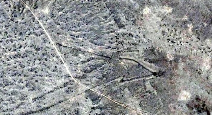
The «arany» were first discovered in 1952 by an archaeological expedition from Khorezm, led by the renowned scholar Sergey Tolstov. These structures consist of long, low stone enclosures laid out on the ground, featuring a distinctive arrow-like shape that becomes particularly noticeable from the air. The layout of the "arrow-shaped formations of Ustyurt" resembles a gigantic military map, with bold arrows indicating the direction of troop movements. The average length of these stone "arrows" ranges from 600 to 900 meters.
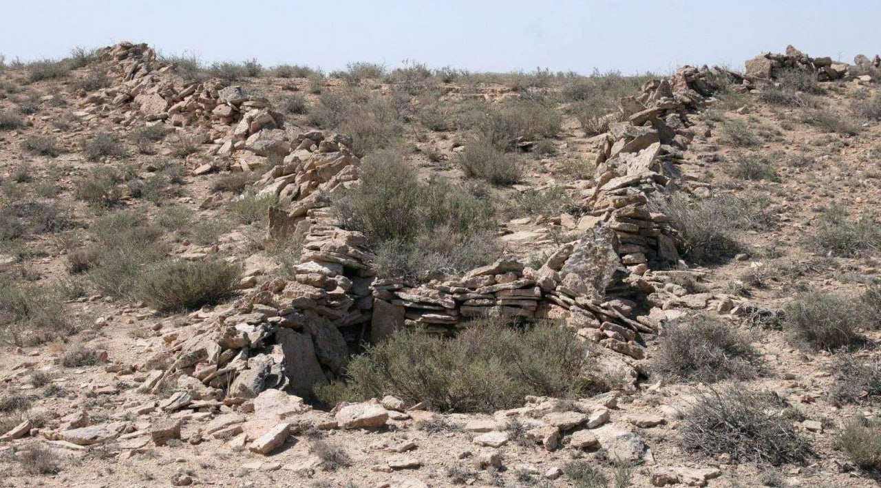
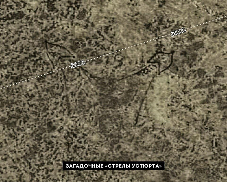 According to the prevailing theory among scholars, the “arany” served as gigantic hunting enclosures or traps. Nomadic tribes used them for the mass capture of hoofed animals, such as saiga antelopes, kulan horses, and gazelles, during their seasonal migrations. The height of the walls of an “arany” typically ranged from 0.5 to 1.5 meters, which was sufficient to prevent the animals from jumping over them, guiding them along the walls instead. The narrow end of the arany often culminated in a pit trap, dug out and reinforced at the tip of the "arrow".
 The Karakalpak scholar H. Esbergenov proposed the hypothesis that the arrow-shaped structures might have been created by nomadic tribes for the collection of rainwater and snowmelt. This theory suggests that the “arany” were not only used as hunting enclosures but also as systems for accumulating water resources in the arid climate of Ustyurt. Such structures could have been vital for the survival of both nomads and wildlife in this harsh environment, providing essential water supplies during dry periods.
The geoglyphs of the Ustyurt Plateau, due to their impressive scale, significantly surpass the more famous system of lines and drawings in the Nazca Desert, representing a similar archaeological phenomenon. These gigantic drawings astonish with their size and precision, raising numerous questions about their purposes and methods of creation. Like the geoglyphs in Peru, the Ustyurt geoglyphs continue to be a subject of study and discussion among scholars and researchers of ancient civilizations.
 According to the conclusion of Dr. V.N. Yagodyn, a Doctor of Historical Sciences and Professor of Archaeology, the arrow-shaped layouts on the Ustyurt Plateau were used for nearly two millennia—from the 5th to the 2nd century BC and continuing into the 14th century AD. Despite extensive research, archaeologists have yet to reach a consensus on the purpose of these enigmatic structures. The “arany” represent unique works of architectural art and serve as monuments to the culture of ancient and medieval nomadic peoples who left their mark on the history of the Southern Aral region.